Michigan’s Last Great Wild Spaces
These are places where nature is enjoyed the way it has been for centuries – in peace, splendor and solitude.


Areas proposed for Wilderness designation
This interactive map illustrates the proposed wilderness areas in Michigan's Upper Peninsula. Click here to expand.
Preserving these areas will ensure a continuous revenue stream for the region, enshrine special forms of recreation, and keep the U.P. wild.
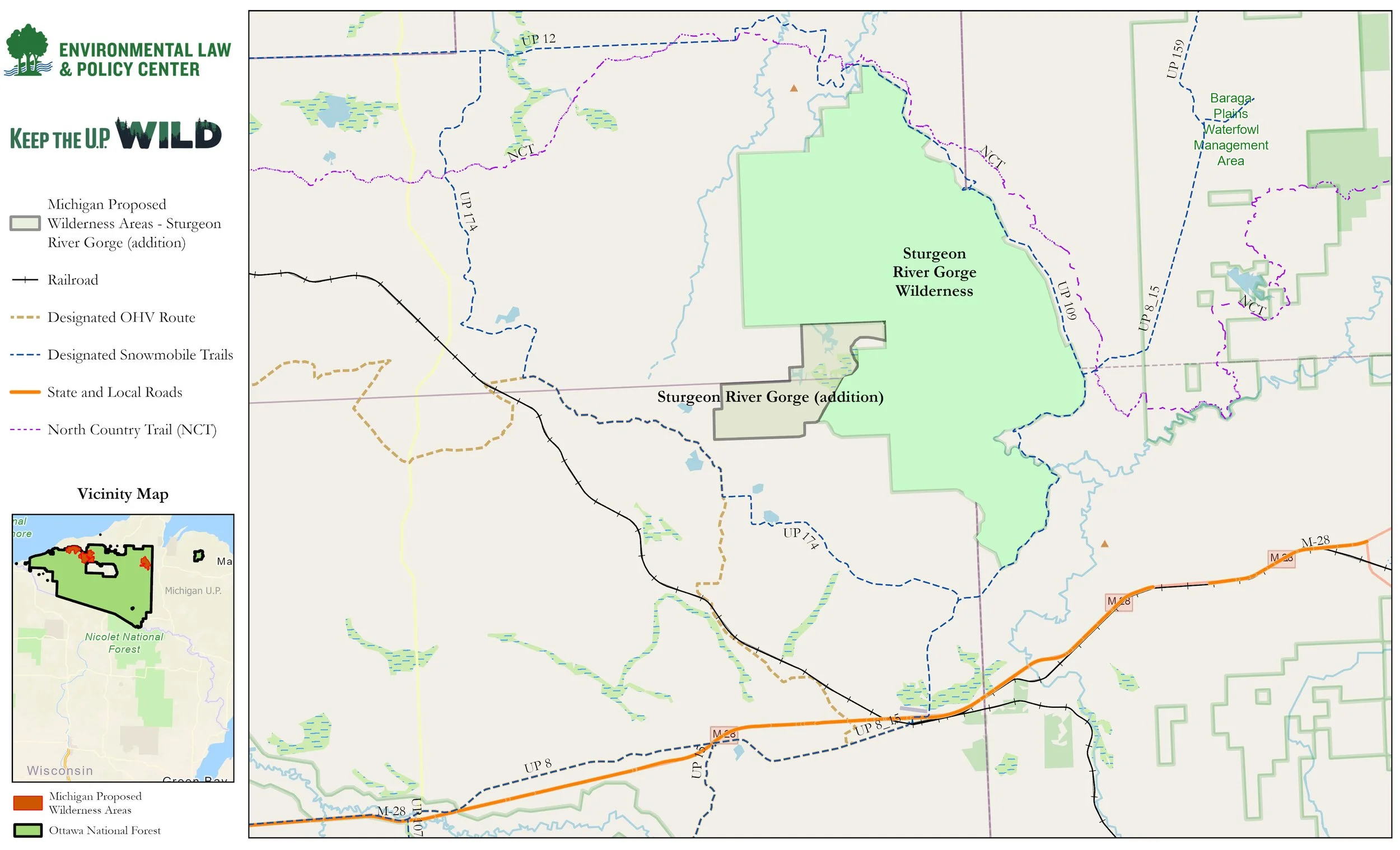
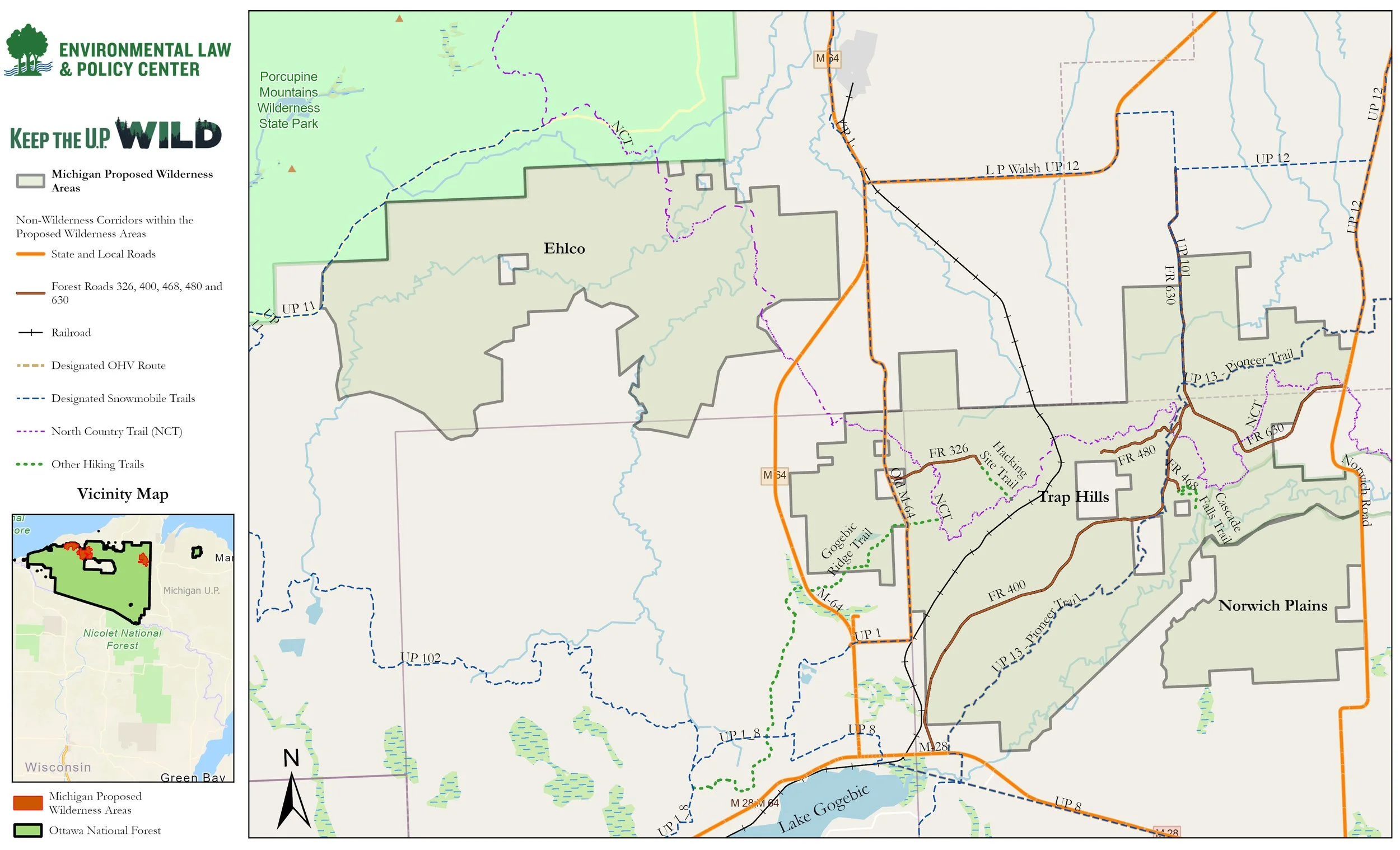
Together, the Ehlco area, the Trap Hills, and Norwich Plains would create a nearly contiguous National Wilderness area of approximately 49,000 acres. Likewise, the Sturgeon River Gorge Wilderness Addition would add nearly 2,000 acres of unique pristine land to the Sturgeon River Gorge Wilderness, creating a total contiguous Wilderness area of almost 17,000 acres.
Our growing and diverse coalition of Michigan environmental, outdoor recreation, political, academic, and business leaders believes preserving these areas for hiking, camping, fishing, hunting, birdwatching, kayaking, canoeing, snowshoeing and the other activities of Wilderness designation protect will benefit us all.
Maps of the Proposed Wilderness Areas
Keep the U.P. Wild is proposing that Congress designate four areas of the Ottawa National Forest in Michigan's Western Upper Peninsula as federally protected Wilderness. See the interactive map here.

In the northwestern portion of the Ottawa National Forest, three proposed Wilderness areas would create a nearly contiguous corridor connected to the beloved Porcupine Mountains Wilderness State Park. Download the map here.
On the eastern edge of the Ottawa National Forest, a fourth proposed wilderness area would expand the cherished Sturgeon River Gorge Wilderness Area. Download the map here.